An iterator across the values in a LatLongCoords object. More...
#include <geospatial.h>
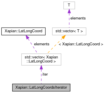
 Collaboration diagram for Xapian::LatLongCoordsIterator:
Public Member Functions | |
| LatLongCoordsIterator () | |
| Default constructor. Produces an uninitialised iterator. More... | |
| const LatLongCoord & | operator* () const |
| Get the LatLongCoord for the current position. More... | |
| LatLongCoordsIterator & | operator++ () |
| Advance the iterator to the next position. More... | |
| DerefWrapper_< LatLongCoord > | operator++ (int) |
| Advance the iterator to the next position (postfix version). More... | |
| bool | operator== (const LatLongCoordsIterator &other) const |
| Equality test for LatLongCoordsIterator objects. More... | |
Private Types | |
| typedef std::input_iterator_tag | iterator_category |
| typedef LatLongCoord | value_type |
| typedef size_t | difference_type |
| typedef LatLongCoord * | pointer |
| typedef LatLongCoord & | reference |
Private Member Functions | |
| LatLongCoordsIterator (std::vector< LatLongCoord >::const_iterator iter_) | |
| Constructor used by LatLongCoords. More... | |
Private Attributes | |
| std::vector< LatLongCoord >::const_iterator | iter |
| The current position of the iterator. More... | |
Friends | |
| class | LatLongCoords |
| Friend class which needs to be able to construct us. More... | |
Detailed Description
An iterator across the values in a LatLongCoords object.
Experimental - see https://xapian.org/docs/deprecation#experimental-features
Definition at line 165 of file geospatial.h.
Member Typedef Documentation
◆ difference_type
|
private |
Definition at line 220 of file geospatial.h.
◆ iterator_category
|
private |
LatLongCoordsIterator is what the C++ STL calls an input_iterator.
The following typedefs allow std::iterator_traits<> to work so that this iterator can be used with the STL.
These are deliberately hidden from the Doxygen-generated docs, as the machinery here isn't interesting to API users. They just need to know that Xapian iterator classes are compatible with the STL.
Definition at line 216 of file geospatial.h.
◆ pointer
|
private |
Definition at line 222 of file geospatial.h.
◆ reference
|
private |
Definition at line 224 of file geospatial.h.
◆ value_type
|
private |
Definition at line 218 of file geospatial.h.
Constructor & Destructor Documentation
◆ LatLongCoordsIterator() [1/2]
|
inlineprivate |
Constructor used by LatLongCoords.
Definition at line 173 of file geospatial.h.
◆ LatLongCoordsIterator() [2/2]
|
inline |
Default constructor. Produces an uninitialised iterator.
Definition at line 178 of file geospatial.h.
Member Function Documentation
◆ operator*()
|
inline |
Get the LatLongCoord for the current position.
Definition at line 181 of file geospatial.h.
◆ operator++() [1/2]
|
inline |
Advance the iterator to the next position.
Definition at line 186 of file geospatial.h.
◆ operator++() [2/2]
|
inline |
Advance the iterator to the next position (postfix version).
Definition at line 192 of file geospatial.h.
◆ operator==()
|
inline |
Equality test for LatLongCoordsIterator objects.
Definition at line 199 of file geospatial.h.
References iter.
Friends And Related Function Documentation
◆ LatLongCoords
|
friend |
Friend class which needs to be able to construct us.
Definition at line 167 of file geospatial.h.
Member Data Documentation
◆ iter
|
private |
The current position of the iterator.
Definition at line 170 of file geospatial.h.
Referenced by operator==().
The documentation for this class was generated from the following file:
- include/xapian/geospatial.h
